The picture above is one I took last year. I remember the moment. I remember the why. It was a rainy Wednesday, just after 5:30 PM. I wasn’t thinking about climbing this particular mountain at the time, and yet… here we are.
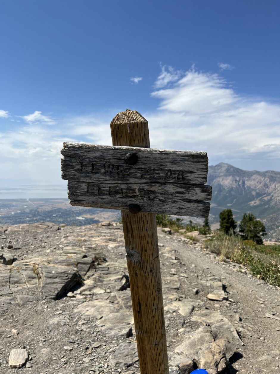
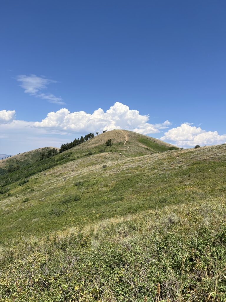
The highest point in this picture is called Lewis Peak. We hadn’t set out to hike that far, but once we reached the top of our intended climb (the Ogden Valley Lookout) from the North Ogden Divide at the Ben Lomond trailhead, we decided to give it a go.
Tara and I both have fond memories of the hike to the Ogden Valley Lookout from when we were kids. Mine were from the hikes I went on while at summer camp in the Eden / Liberty / Nordic valleys on the other side of the mountains. We also took our two oldest kids on the hike almost twenty years ago when I got out of the Air Force and we returned to Utah after living in Anchorage, Alaska for four years during my OCONUS (Outside the Continental US) Long tour.
I suppose it’s safe to say that I’ve grown a bit older since then, and the trail was much more difficult in my memories. But, as it turns out, it wasn’t quite as hard as I remembered. Perhaps it’s our regular 3-mile walks around our hilly neighborhood, or not hiking with two small children… but it could just as easily be a building sense of determination to do hard things that propelled me forward.
I still got winded and had to stop for breathers here and there, and I still had to make sure I took my heart meds before we left, but we did it.
We did it, and then I wanted more.
I had always wondered as a teen what existed further up the trail. I would sit with my camp friends, enjoying my lunch as I looked out across the little bit of the world that I knew, and I would wonder.
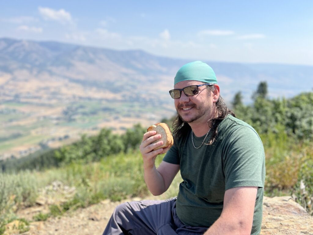
After Tara and I ate the sandwiches that she had lovingly made, I made up my mind. If she was willing, I wanted to find out what existed beyond that point. I wanted to know more about the world I never took the time to explore. We didn’t have to go the whole way, but just a little bit further.
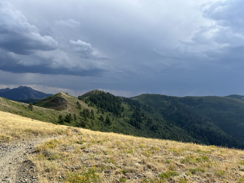
‘Just a little bit further and then we’ll see’ turned into ‘Just a little bit more.’ Before we knew it, it made more sense to keep pushing forward than it did to turn back. Still, we had to understand our own limits. We had already traveled a significant distance beyond our original goal by the time we reached the sign above. The sun was hot, our legs and feet were tired, and there wasn’t much shade, but we still had some wind in our sails.
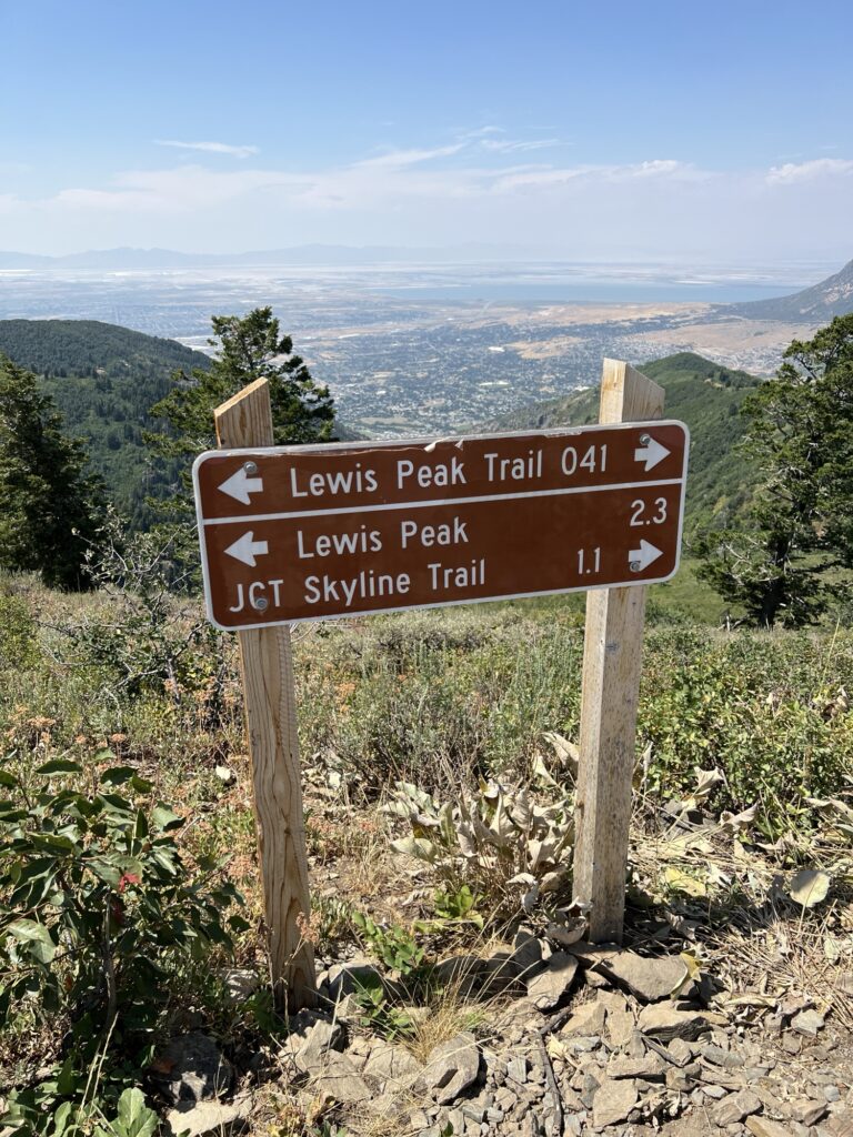
2.3 miles is not insignificant, but it felt doable. That number can be deceiving, though. What you hike out, you have to hike back. Each summit you conquer must be conquered again from the opposite side.
Yes, we were hot and tired, but we still had plenty of water and time. So, we continued.
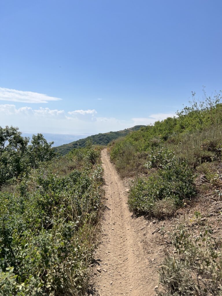
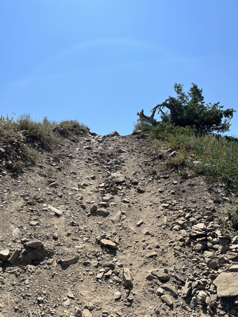
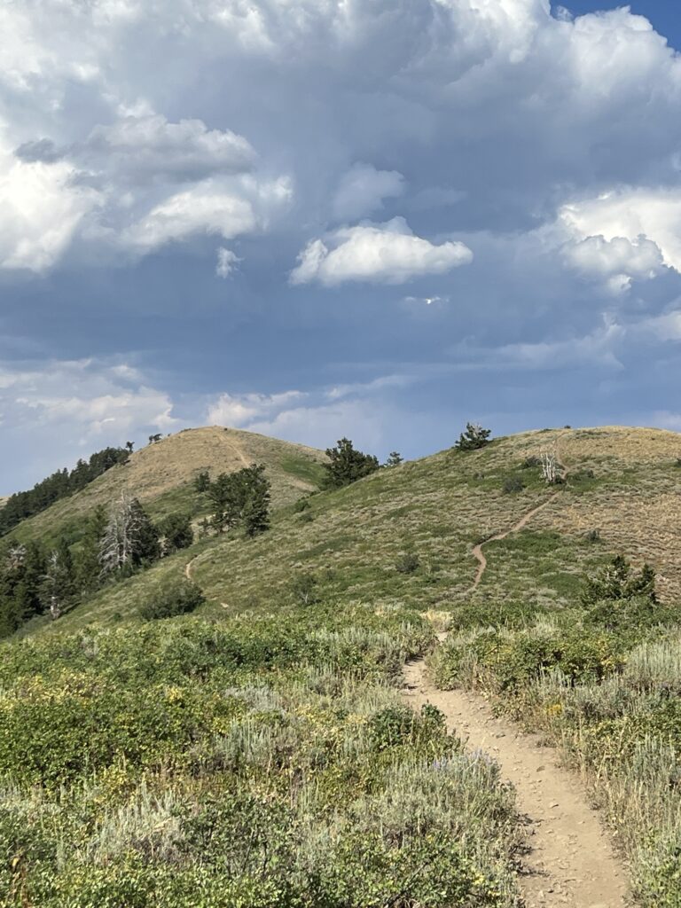
The trail was easy in some places and hard in others. The views were beautiful and awe inspiring. We hiked up and over lesser hills and peaks, such as Nelson Summit and Eyrie Peak, along the way. The sun continued to burn, and our arms turned red in the sometimes sweltering heat. A light breeze would sometimes sweep across the mountaintops, bringing with it brief moments of reprieve. The going was hard and the sun was hot. There still wasn’t much shade along the ridge lines, and we were a bit desperate for the company of trees, but we kept going.
Once you set your mind to something, having chosen your hard, the desire to turn back tends to get lost in the rhythmic crunching of footsteps along the path. Much like getting lost in the feeling of flow, time tends to slip away until all that remains is the next step. Then the one after that.
Your feet might tire, and you may begin to feel the germinating seeds of ache that will persist for days after you’ve accomplished your feat, but none of that matters. Not then. Not in the moment of the struggle. All that exists is the trail, your partner, and the challenges that are yet to come.
At other times, not so much.
Distant clouds looked dark and heavy, but the sky above remained clear for much of our trek. Clear enough to send near-endless streams of sweat pouring down my forehead and cheeks. Drops of the salt-heavy perspiration would fall to the dust-covered trail, only to be soaked up by the earth’s near unquenchable thirst.
Grasshoppers and birds were no strangers to these strange heights. This year has been remarkably bad as far as grasshoppers go. We’ve had an over abundance in our yard, and their presence at such heights was surprising. At one point, while recording a small section of the trail, one landed on my face and I had no choice but to either end the recording and commence freaking out or continue walking and filming despite my unwanted passenger.
Through sheer force of will, I chose the latter.
From the summit, you can look out over the Ogden valley and watch tiny cars driving familiar roadways. You can see the newer, cookie-cutter neighborhoods and the older housing areas filled with more eclectic and varied builds.
To the southwest is Hill Air Force Base, to the west are industrial complexes, BDO, and even further the Great Salt Lake — which hasn’t been so great in recent, drought-filled years. Even Antelope Island, which isn’t so much of an island as a weird peninsula lately. To the northwest is Fremont Island and, beyond that, Promontory Point and Willard Bay.
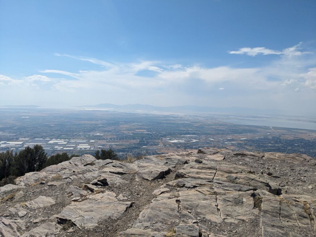
I failed to capture the valley views once we reached the top, but Tara had my back. Above, you can see the world as we saw it beneath the craggy summit.
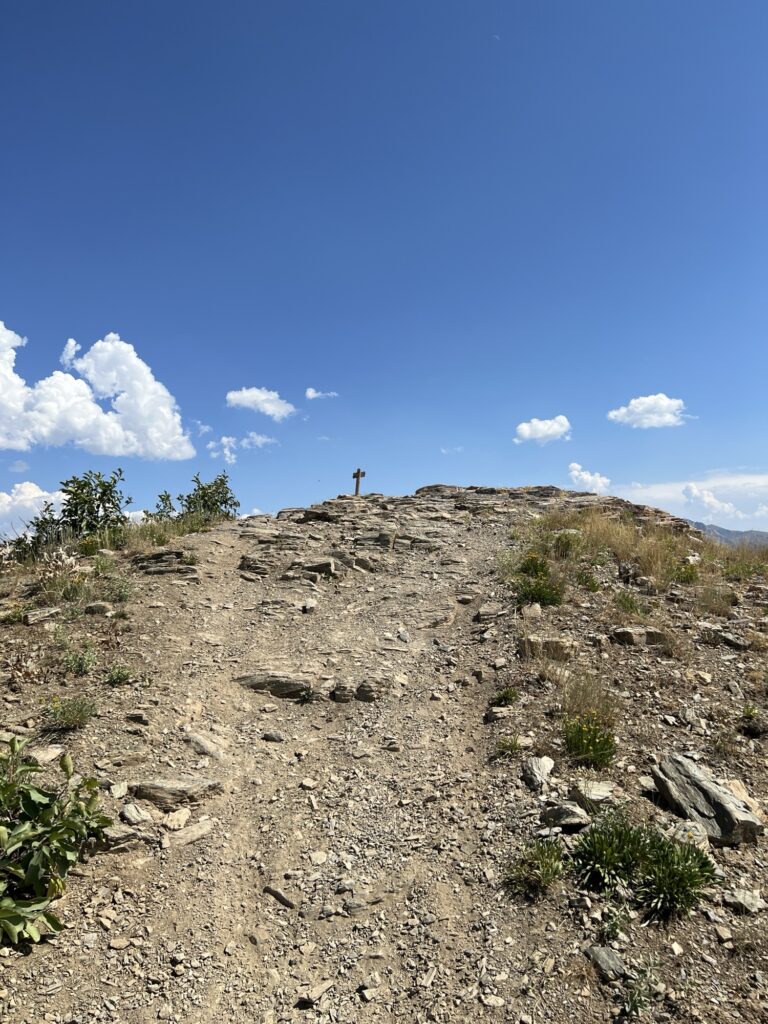
By the time we reached the top, we could see a rather large storm creeping in from the south. It seemed to be moving slowly. Slow enough that we weren’t too worried about taking our time to eat a protein bar and enjoy the sights and solitude.

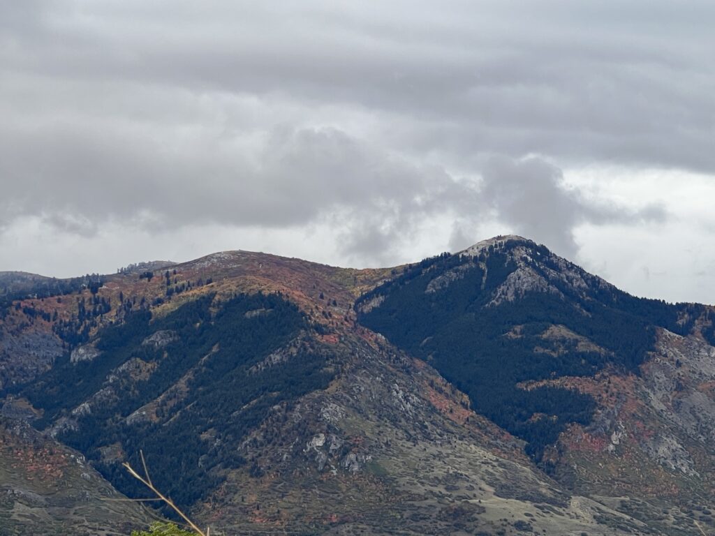
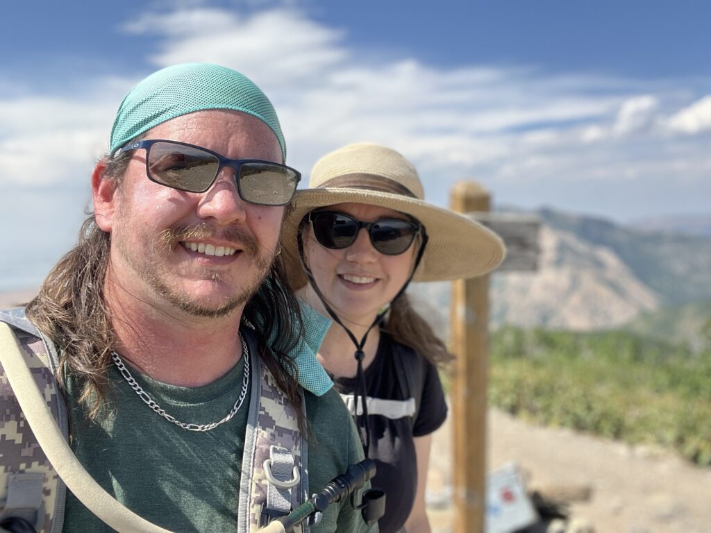
Ben Lomond Peak looms in the background.
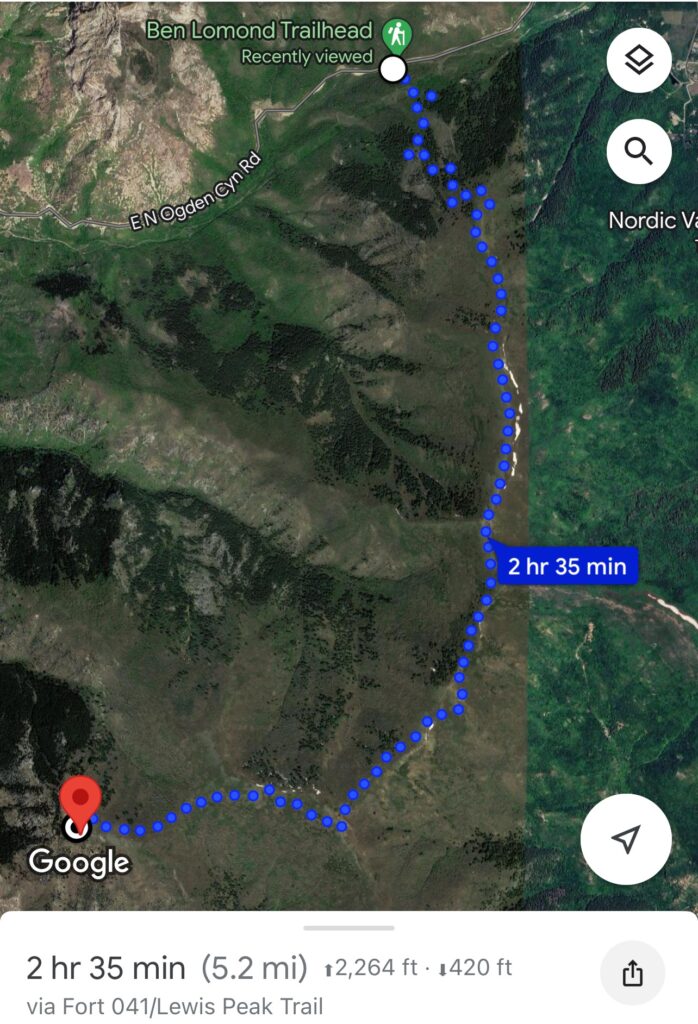
To get a better sense of our adventure to this point, here is a snapshot from Google Maps. See the picture below or click the link to open in a new tab and zoom in via satellite view to get a closer, more detailed view of the trail.
Of course, getting to Lewis Peak was only half the journey. With our protein bars consumed, our legs at least somewhat rested, and the sun still blazing, we set our sights toward home. We were not alone, however, because it seemed the storm was coming with us.
The dark clouds grew darker in our wake, and we could hear thunder echoing down the range as we went. The storm’s slow creep had turned into a sweeping shadow that threatened to consume everything in its path.
And in its path… we hiked.
Above was the view before us. Below was the view behind.
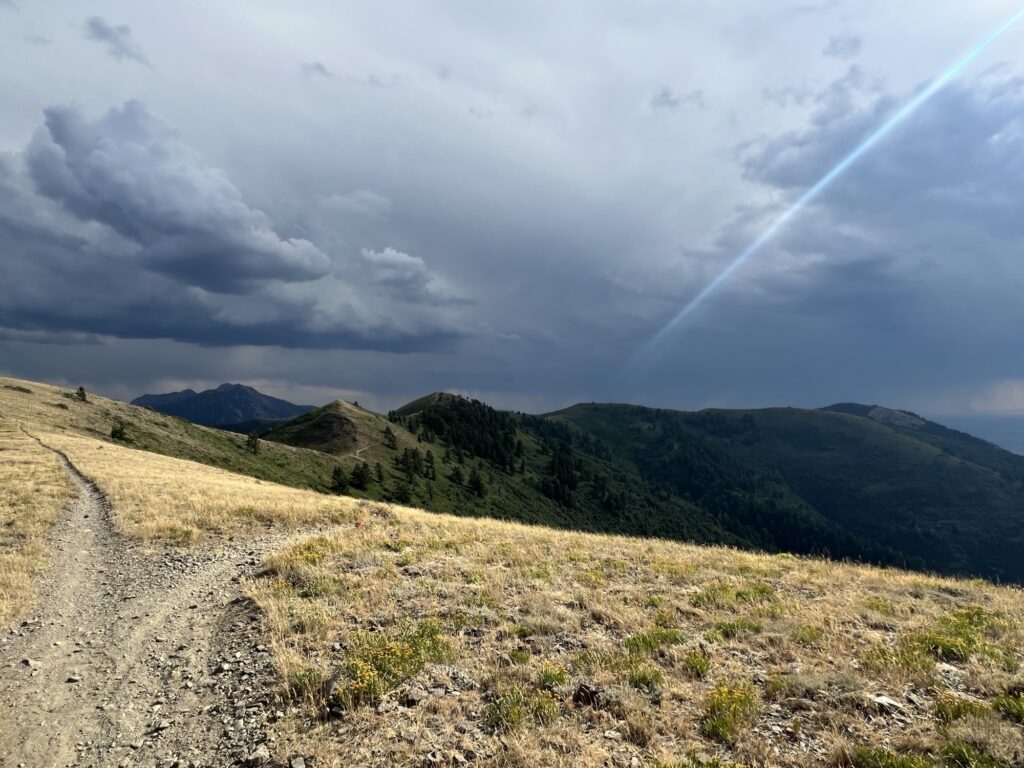
The thunder was a constant warning.
The picture doesn’t really do justice to how dark and menacing this thing was, and I certainly didn’t feel like sticking around to get a better shot. One thing I know about being on top of a mountain during a thunderstorm is that you don’t want to be the tallest thing around. Lightning can be a very real danger. With that in mind, we picked up the pace and kicked our hike into our fastest gear. Which, as it turns out, was actually much faster than I had anticipated.
I ended up rolling my ankle at one point where the trail got a bit nasty, but my ‘step-on-a-Lego-in-the-dark’ parent skill kicked in and I was able to step out of it without suffering much of a lasting injury. It still hurt, though, and my feet were killing me by the time we got back to the point from which we started. If I’m being honest, I have a terrible habit of kicking rocks and roots once I start getting tired, so the pain was probably more in my toes than in my ankle.
All told, out and back and with stops to rest or sight see, it took us eight hours and twenty-seven minutes from start to finish. That’s a lot more than the five hours and ten minutes that Google says it should have taken, no stops, just straight hoofing it. But I’m okay with that.
In the end, we set out for a small hike and ended up conquering a mountain. We chose our hard, and we won. Now we’re one step closer to taking on Ben Lomond… We just have to keep going.
One mountain at a time.
Speaking of which, did you catch my previous post about Hiking Up the Mountain to reach Malan’s Basin?
One Comment on “Conquering Lewis Peak”
Pingback: Hiking up the Mountain | R. Brady Frost, Author